MoMI presents a photographic record of a late-summer road trip to Massachusetts to enjoy the sights, history, and culture of this part of New England. Entering the United States via the Thousand Islands Bridge in upper New York State and travelling via the New York State Thruway and Massachusetts Turnpike, this trip included visits to Stockbridge, Boston, New Bedford, and Cape Cod. From sandy Atlantic Ocean beaches to quaint fishing villages, and from the cobblestoned history of Revolutionary America to the thriving energy of 21st century urban Boston, we hope you enjoy this tour of one of the most interesting of American states.
*As the original
Spirit of Massachusetts tourism campaign aired in 1986-87, please
do not call 1-800-624-MASS for more information.
Day 1 (16 August): U.S. Border - Syracuse, New York
After a short drive from the border on Interstate 81, we pulled off at Exit 46 in Watertown, New York for lunch at one of America's greatest restaurant chains, Cracker Barrel Old Country Store and Restaurant (www.crackerbarrel.com/):
 |
| Each Cracker Barrel Old Country Store and Restaurant is exactly the same outside, with a covered wooden veranda and rocking chairs. |
 |
| The distinctive highway-side signage used by Cracker Barrel. |
 |
| The 'Old Country Store' portion of a Cracker Barrel restaurant features clothing, household decor, gifts, and a variety of well-known food and candy. |
 |
| The general store-style counter, where customers pay their restaurant bills and can purchase any items from the store. |
 |
| The hostess podium and entrance to the restaurant part of Cracker Barrel. |
 |
| A part of the typical dining room layout in a Cracker Barrel restaurant. |
 |
| Diners (faces electronically obscured to protect privacy) enjoy the eclectic decor and country-style meals served at Cracker Barrel, which include ham steak, meatloaf, chicken and dumplings, collard greens, mashed potatoes & gravy, corn muffins, and cinnamon apples. |
The Baymont Inn & Suites, East Syracuse, NY:
After checking in and dropping off bags, we ventured to the Destiny USA shopping mall in Syracuse, located just off Interstate 81. After some shopping, we enjoyed upscale Mexican cuisine--including guacamole made fresh at the table--at Cantina Laredo, located inside Destiny USA.
 |
| Room keycards and keycard sleeve for Room 206 at the Baymont Inn & Suites, Syracuse, New York. |
Day 2 (17 August): Syracuse, NY - Boston, MA
 |
| Driving on the Massachusetts Turnpike. |
 |
| The Red Lion Inn in Stockbridge, a quaint town in the Berkshire Mountains of western Massachusetts, located a short drive off the Massachusetts Turnpike. |
 |
| Originally opened in 1773 as a tavern, the Red Lion Inn was expanded in 1848 and 1884, burned down in 1896, was rebuilt in 1897, renovated in 1956 and 1960, and began operating year-round in 1969. It now features 125 guest rooms, various dining options, live nightly entertainment, and a gift shop featuring many items locally-made in the Berkshires. |
 |
| A cocktail napkin from the Red Lion Inn in Stockbridge, Massachusetts. |
 |
| Arriving in Boston via the Massachusetts Turnpike. The tall building is the 52-story Prudential Tower, the second-tallest building in Boston (after the John Hancock Tower), completed in 1964. |
 |
| Speeding through the underground John F. Fitzgerald Expressway (Central Artery) under the streets of downtown Boston. |
 |
| Keycards and keycard envelope for Room 714 at the Hampton Inn, Boston-Cambridge. |
Day 3 (18 August): Boston, MA
Some photos from an early morning walk along the Charles River in Boston on 18 August:
 |
| A look along the tranquil Storrow Lagoon, part of the Charles River Esplanade park system the runs along the southern shore of the river. |
 |
| The Longfellow Bridge crossing the Charles River from Boston to Cambridge, near the Massachusetts Institute of Technology (MIT). |
 |
| A view of the urban skyline of Boston's Back Bay neighbourhood, as seen from the Charles River Esplanade in the early morning of 18 August. |
 |
| The Museum of Science, located in Science Park, just off the Monsignor O'Brien Highway crossing the Charles River from Boston to Cambridge. Along with 700 exhibits, the museum features the Charles Hayden Planetarium and the only domed IMAX screen in New England. |
After a hearty breakfast at the Hampton Inn Boston-Cambridge, we jumped on one of the light rail vehicles servicing the Green Line at Lechmere Station and headed downtown...
 |
| The front and back sides of a CharlieCard, the reloadable transit pass that allows quick and easy access to the buses, subways, and light rail operated by the Massachusetts Bay Transportation Authority. |
 |
| A view inside a Kinki-Sharyo Type 7 LRV on the Green Line. One hundred Type 7 vehicles were ordered from the Japanese manufacturer by the Massachusetts Bay Transportation Authority (MBTA) in 1987, with a further 20 vehicles ordered in 1997. |
 |
| The Boston Common Visitor Centre, located at one of the park entrances on Tremont Street. The Visitor Centre provides tourist information and is the departure point for guided tours by guides in Revolutionary War period costume. |
 |
| The lawns and trees of Boston Common. |
 |
| Brewer Fountain, located in Boston Common near the corner of Park and Tremont Streets. The 22-foot tall bronze fountain was cast in Paris and is a replica of a fountain installed at the 1858 Paris World's Fair. Brewer Fountain was gifted to the city of Boston by Gardner Brewer in June 1868, and features the Greek mythological figures of Neptune, Amphitrite, Acis, and Galatea. A year-long restoration of the fountain starting in 2009 finished with its re-dedication on May 26, 2010. |
 |
| Boston Common, looking northeast toward Beacon Street. |
 |
| The Massachusetts State House, the state capitol and seat of the government of the Commonwealth of Massachusetts, located on Beacon Street, across from Boston Common. The building houses the legislature and the Governor's office. Built between 1795 and 1798, the building saw an annex added in 1895 and east and west wings added in 1917. |
 |
| Built on 6.7 acres of land formerly belonging to John Hancock, the first elected Governor of Massachusetts, the State House is best known for its gold leaf-gilded dome. The original (and leaky) wooden dome was replaced by a copper one in 1802, with the gold-leaf being applied in 1874. The dome is topped by a pine cone, symbolising the importance of the lumber industry to the economy of the Massachusetts colony. |
 |
| The Robert Gould Shaw and Massachusetts 54th Regiment memorial, located at the edge of Boston Common on Beacon Street, directly across from the Massachusetts State House. The bronze relief sculpture, unveiled on 31 May 1897, depicts the all-African American 54th Regiment Massachusetts Volunteer Infantry marching down Beacon Street on 28 May 1863. Shaw was the colonel commanding the Massachusetts 54th Regiment and was killed during the American Civil War, leading his troops at the Second Battle of Fort Wagner near Charleston, South Carolina on 18 July 1863. |
 |
Park Street Church, located at the corner of Park and Tremont Streets, across from Boston Common, completed in 1809. The Conservative Congregationalist church is one of the stops on Boston's Freedom Trail of sites associated with the American Revolution and its 217-foot steeple was the tallest building in the U.S. between 1810 and 1846.
|
 |
The Old Granary Burial Ground adjacent to Park Street Church. This cemetery, established in 1660, is the resting place of numerous Revolutionary War-era figures, including three signers of the Declaration of Independence (Samuel Adams, John Hancock, and Robert Treat Paine), Paul Revere, and the victims of the Boston Massacre of 1770. Although there are 2,345 marked graves, historians believe that up to 5,000 people may be buried here.
|
 |
The grave of Samuel Adams, statesman and philosopher, one of the Founding Fathers of the United States. Adams served as fourth Governor of Massachusetts from 1794 to 1797, before his death on 2 October 1803.
|
 |
The Tremont Temple Baptist Church on Tremont Street. The building was completed in May 1896.
|
 |
| A closeup view of the intricate masonry and tiling of the Tremont Temple Baptist Church. |
 |
The Omni Parker House Hotel, located at the corner of Tremont and School Streets and best known as the birthplace of the Boston Cream Pie. The hotel was built in 1927 on the site of the earlier Parker House Hotel of 1855, and features 551 rooms and suites. Vietnamese Communist leader Ho Chi Minh worked as a baker in the hotel from 1911 to 1913, and Malcolm X was employed as a busboy in the 1940s. John F. Kennedy announced his candidacy for the Congress in the hotel in 1946 and held his bachelor party here in 1953.
|
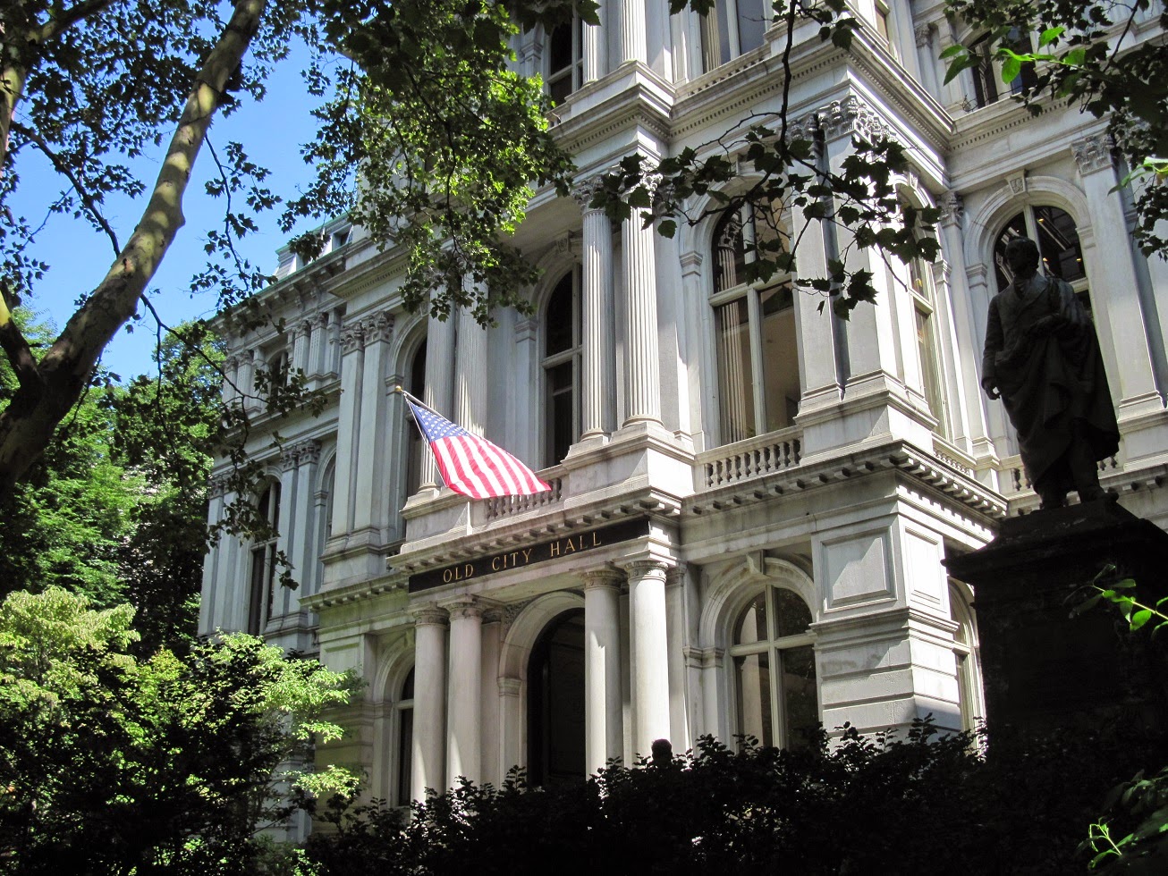 |
Boston's Old City Hall, located on School Street. Built between 1862 and 1865, this Second Empire style building housed Boston's municipal offices until 1969. The site currently houses several retail businesses, and a Ruth's Chris Steakhouse.
|
 |
| A look down School Street. |
 |
| Old South Meeting House, located at the corner of Milk and Washington Streets and completed in 1729. It was in this church--the largest in Boston at the time--that the Boston Tea Party was organised, following a meeting of 5,000 angry colonists. Following the 1775 occupation of Boston by British forces, the interior of Old South Meeting House was gutted and used by British troops for riding practice. |
 |
| The memorial to the victims of the Irish Famine, located across the Street from the Old South Meeting House at Washington and School Streets. |
 |
| Looking south at Post Office Square at the intersection of Congress and Water Streets. The building in the centre of the photo is the John W. McCormack Post Office and Court House. |
 |
The 496-foot tall Custom House Tower in downtown Boston. The tower was erected in 1915 on top of the existing Custom House, built in 1849. After extensive renovations in 1997, the Custom House was reopened as a Marriott hotel, featuring 87 one-bedroom suites.
|
 |
Old State House, located at Washington and State Streets in downtown Boston. Completed in 1713, the building housed the colonial government until 1776. The Declaration of Independence was read from the balcony on 18 July 1776. From 1776 to 1798, the Massachusetts state government occupied the building, and from 1830 to 1841 it was the seat of Boston's city government. Housing a variety of commercial businesses until 1881, Old State House is now a museum operated by the Bostonian Society and is the oldest surviving public building in Boston. The lion and unicorn figures on the building's roof reflect the British colonial origins of Old State House.
|
 |
The John Fitzgerald Kennedy Federal Building, located in the Government Centre area of Boston, near City Hall. The twin 26-story towers are 387 feet tall, and were designed by renowned German-born architect Walter Gropius. Construction began in 1963 and was completed in 1966, with the building being dedicated to the recently-assassinated President John F. Kennedy on 9 September 1966.
|
 |
A marker on the ground beside Old State House shows the location of the 5 March 1770 Boston Massacre, when British sentries--provoked by an angry mob of local Boston residents--opened fire, killing five and injuring six. The incident was a rallying cry for American revolutionaries.
|
 |
Faneuil Hall, built in English country market style in 1742 by merchant Peter Faneuil as a gift to the city of Boston. Funded in part with the profits of slave trading, Faneuil Hall hosted a number of fiery speeches by Samuel Adams and others espousing American independence. The building was gutted by fire in 1761 and rebuilt in 1762, followed by further renovations in 1805. Market stalls occupy the ground floor, with an assembly hall on the second and third floors, and the headquarters of the Ancient and Honorable Artillery Company of Massachusetts on the fourth floor.
|
 |
| A look down the staircase inside Faneuil Hall. |
 |
| The assembly hall on the second floor of Faneuil Hall. |
 |
The headquarters of the Ancient and Honorable Artillery Company of Massachusetts, the oldest chartered military organisation in North America. The unit has been housed here in Faneuil Hall since 1746. The headquarters houses an armoury and museum, open to the public.
|
 |
| Established as a citizen militia to defend Britain's northern American colonies, the Ancient and Honorable Artillery Company of Massachusetts has become a ceremonial and social organisation, and the honour guard for the Governor of Massachusetts, who is its Commander in Chief. |
 |
A view of the grounds of Quincy Market, located behind Faneuil Hall.
|
 |
The principal building of the Quincy Market complex, built between 1824 and 1826 and built in the Greek Revival style. Named after Boston Mayor Josiah Quincy, the 535-foot long market housed indoor market stalls for meat and produce vendors.
|
 |
A view inside Quincy Market today. After the departure of most vendors to more modern facilities elsewhere in the city, Quincy Market fell into disrepair and was slated for demolition. In the late 1970s, a major public-private renovation and restoration effort transformed Quincy Market into a popular tourist destination, featuring dozens of food vendors selling a wide variety of menu items, from clam chowder, sandwiches, and Boston cream pie, to sushi, pizza, and ice cream.
|
 |
| Visitors spend a sunny Monday afternoon strolling through Quincy Market. |
 |
The Chart House restaurant, the oldest surviving structure on the Boston waterfront's Long Wharf. Formerly the John Hancock Counting House, the restaurant features a wide selection of seafood and other dishes.
|
 |
| Boats moored at one of the marinas along the Boston waterfront. |
 |
Looking up Long Wharf, the point of departure for whale watching boats, sightseeing cruises, and ferries to the Boston Harbor Islands and Cape Cod.
|
 |
One of the New England Aquarium's whale watching excursion boats departs from Long Wharf.
|
 |
| Ticket stub for a harbour cruise aboard a Boston Harbor Cruises vessel. |


 |
| Aboard a Boston Harbor Cruises sightseeing vessel as it pulls away from the dock at Long Wharf. |
 |
| A view of Boston's Financial District as seen from the harbour. Number One International Place (built 1987) is the tall building on the left, while Number Two International Place (built 1992) is the tall building on the right. |
 |
| Lobstermen pull traps out of Boston Harbor. |
 |
| The Boston skyline as seen from the outer harbour. |
 |
| An Emirates Airlines Boeing 777 lands at Boston Logan International Airport. |
 |
| A view of Boston's outer harbour. Some of the Boston Harbor Islands can be seen in the distance, behind the sailboats. |
 |
| A speedboat dashes through Boston Harbor. |
 |
| The Deer Island Waste Water Treatment Plant, built in 1995 and operated by the Massachusetts Water Resources Authority. The facility is the second-largest waste water treatment plant in the United States, and has been a crucial component in the clean-up of Boston Harbor, which was previously badly polluted. The egg-shaped structures are solid waste digesters. |
 |
| The Nantucket Light Ship, docked in Boston Harbor. |
 |
| The 87-foot U.S. Coast Guard Marine Protector-class patrol boat USCGC Flyingfish, moored alongside U.S. Coast Guard Base Boston. |
 |
| Looking northwest from Boston's inner harbour. The white steeple in the centre of the photo belongs to the Old North Church. |
 |
| A historic sailboat now serving as a sightseeing vessel passes on its way out from Long Wharf. |
 |
| Ye Olde Union Oyster House, one of the oldest restaurants in the United States, has operated since 1826. A National Historic Landmark, the building likely was constructed in 1704 and hosted other businesses, including a newspaper, before becoming the Atwood & Bacon Oyster House on 3 August 1826. Louis Philippe, King of France between 1830 and 1848 lived on the second floor in 1796 while in exile in the United States. The restaurant specialises in classic New England dishes, including oysters, clams, lobster, baked beans, and steaks and chops. |
 |
| The Green Dragon Tavern, established in 1654, located on the cobblestoned Marshall Street. It is rumoured that it was in the Green Dragon that British plans for the invasion of Lexington and Concord were overheard, prompting Paul Revere's midnight ride to warn residents. |
 |
| A historic building on Marshall Street and Creek Square, now housing the offices of Swartz & Swartz law firm. |
 |
| Dusk at the CambridgeSide Galleria shopping centre in Charlestown. The mall, which opened in 1990, features 133 stores and services, with Macy's, Macy's Home Store, BestBuy, and Sears as anchor stores, as well as a number of upscale designer brands. |
 |
| A napkin from P.F. Chang's, an American restaurant chain specialising in Chinese cuisine. The CambridgeSide Galleria is home to a number of dining options, including P.F. Chang's, California Pizza Kitchen, and Cheesecake Factory. |
 |
| A napkin from Chipotle Mexican Grill, located in the food court of the Cambridgeside Galleria. |
Day 4 (19 August): Boston, MA
A brisk early morning walk through Beacon Hill provided an opportunity to see Boston's most exclusive--and expensive--residential neighbourhood.
 |
| An early morning view of the intersection of Charles and Revere Streets. |
 |
The corner of Charles and Mt. Vernon Streets. Charles Street hosts a variety of quaint boutiques, cafes, produce stores, and antique shops.
|
 |
Bronze sculptures of a duck and her ducklings, based on the main characters of the children's story Make Way for Ducklings (1941), written and illustrated by Robert McCloskey. These sculptures are located near the Charles/Beacon Street entrance to the Boston Public Garden.
|
 |
Crossing the bridge over the pond in the Boston Public Garden. The bridge was opened in 1867.
|
 |
Willow trees overhang the pond in the Boston Public Garden.
|
 |
Looking across the pond in the Boston Public Garden. Rising above the trees are the John Hancock Tower, Arlington Street Church, and the Berkeley Building.
|
 |
Row houses at the corner of River and Beacon Streets, located across the street from the Boston Public Garden.
|
 |
On the way back to the hotel for breakfast... A Green Line light rail vehicle prepares to depart Boylston Station, near Boston Common.
|
 |
| A swan boat plies the calm waters of the pond in the Boston Public Garden. |
 |
| People enjoy the summer weather by the pond in the Boston Public Garden. |
 |
| A view of the landscaped ornamental gardens. |
 |
Following the path southwest toward the entrance at Boylston and Arlington Streets.
|
 |
| The wrought iron gates at the entrance to the Boston Public Garden. |
 |
A bronze equestrian statue of George Washington, dedicated on 3 July 1869. The statue faces west, looking out over Commonwealth Avenue.
|
 |
A view of Arlington Street Church, as seen from just inside the Boston Public Garden. The building was constructed atop 999 wooden piles driven into the mud of Back Bay, and made of brownstone quarried in New Jersey.
|
 |
The Arlington Street Church, a Unitarian Universalist church, at the corner of Arlington and Boylston Streets. Construction was begun in 1859 and the church completed in 1861. The 190-foot steeple contains 16 bells, each with a Biblical inscription, which are still rung by hand.
|
 |
Old South Church at the northwest corner of Copley Square. Built in 1874 in the Gothic Revival style, the church houses a United Church congregation. The 246-foot tower houses the church's 2,020 lb. bell.
|
 |
| A closer view of the intricate masonry of Old South Church. |
 |
The Boston Public Library's McKim Building, as seen from the lawn of Copley Square. The Italian Renaissance style building is named after its architect, Charles Follen McKim.
|
 |
| The plaza in front of the Boston Public Library's McKim Building, built in 1895. |
 |
The intricate, wrought iron gates and lighting fixtures at the entrance to the Boston Public Library's McKim Building.
|
 |
The library's entrance hall, featuring pillars of Iowa sandstone, a vaulted ceiling covered in marble mosaic, and a floor of white Georgia marble, inlaid with brass signs of the zodiac.
|
 |
Entering from a deep triumphal arch, the steps of the library's main staircase are crafted from fossil-studded grey Eschaillon, with variegated yellow Siena marble comprising the walls.
|
 |
| The main staircase features twin lion sculptures on pedestals, crafted from unpolished Siena marble. The sculptures are memorials to the 2nd and 20th Massachusetts infantry regiments which fought during the Civil War. |
 |
| The memorial to the 20th Massachusetts Volunteer Infantry. |
 |
Located at the centre of the library, a quiet courtyard is flanked by an arcaded promenade modelled on that of the Cancelleria Palace in Rome. A fountain featuring Frederick MacMonnies' bronze sculpture of Bacchante and Infant Faun adorns the centre of the courtyard.
|
 |
The Abbey Room, a 64-foot long, 33-foot wide gallery clad in rouge antique and Levanto marble and dark oak panelling. The floor is finished in Istrian and red Verona marble, while the ceiling consists of heavy and intricately-carved wooden rafters. The main feature of this room is the series of murals by American artist Edwin Austin Abbey, depicting the search for the Holy Grail.
|
 |
The John Singer Sargent Gallery, featuring the artist's original mural sequence, entitled Triumph of Religion. The windowless gallery is 84 feet long, 23 feet wide, and 26 feet high and crafted from dark sandstone.
|
 |
Bates Hall, the main reading room in the Boston Public Library's McKim Building, named after benefactor Joshua Bates (1788-1864). This 218-foot long, 42-foot wide, and 50-foot high room occupies the entire front of the McKim Building on the second floor and features an impressive vaulted plaster ceiling.
|
 |
The Fairmont Copley Plaza Hotel, situated at the corner of St. James Avenue and Dartmouth Street, on the south side of Copley Square. The hotel, built in the Beaux-Arts style, was opened in 1912.
|
 |
| The main entrance to the Fairmont Copley Plaza Hotel. |
 |
| The hotel's Peacock Alley. |
 |
The lobby of the Fairmont Copley Plaza Hotel, featuring a 21-foot high gilded, coffered ceiling, crystal chandeliers, and Italian marble columns. The hotel contains 383 rooms.
|
 |
Trinity Church, an Episcopal church built in the Richardsonian Romanesque style between 1872 and 1877 and notable for its clay roof, differently coloured and rough stone, heavy arches, and large tower. Inside, murals by American artists cover over 21,500 square feet.
|
 |
People enjoy a sunny lunch hour at the Copley Square fountain, located on the Boylston Street edge of the square. Copley Square, called Art Square until 1883, is named after painter John Singleton Copley and took on its present arrangement in 1966. The square is bounded by Boylston Street to the north, Clarendon Street to the east, St. James Avenue to the south, and Dartmouth Street to the west.
|
 |
The John Hancock Tower (officially known as Hancock Place), New England's tallest building, located adjacent to Copley Square. Construction on the 60-story, 790-foot tall tower commenced in 1968 and it opened in 1976, with its principal tenant being the John Hancock Insurance Company.
|
 |
| Farmers' market stalls ring Copley Square. |
 |
Locals and tourists peruse fresh produce, flowers, baked goods, meats, and cheeses at the farmers' market in Copley Square.
|
 |
Stately homes--many now occupied by clubs, academic institutions, and small businesses--line Commonwealth Avenue in the Back Bay neighbourhood near Copley Square.
|
 |
The tree-lined Commonwealth Avenue Mall runs between the lanes of Commonwealth Avenue.
|
 |
| Stately federal style row houses line Commonwealth Avenue. |
 |
A statue of Brigadier General John Glover, who served in the Continental Army during the Revolutionary War. The statue was installed in Commonwealth Avenue in 1875, one of a number of statues, sculptures, and memorials located along the length of Commonwealth Avenue.
|
 |
One of the historic office buildings in downtown Boston, located next to the Old State House at the intersection of Devonshire, Congress, and State Streets.
|
 |
A view up State Street, with the Custom House Tower rising above neighbouring buildings.
|
 |
Looking up at the rotunda inside Custom House Tower, now an 87-room Marriott hotel.
|
 |
| A napkin from the Marriott Custom House hotel, depicting the Custom House Tower and summarising its history. The napkins are available at the table holding the urn of iced citrus water in the lobby. |
 |
| The Custom House Tower rotunda houses a small collection of maritime artefacts and nautical paintings. |
 |
King's Chapel, situated at the corner of Tremont and School Streets. The Georgian style building was completed in 1749. The church sits on the same site as the original, wooden King's Chapel built in 1688, and the present stone building was constructed around the original wooden building, whose timbers were then disassembled and removed through the windows of the new church. Although a steeple was originally planned, a shortage of funds prevented its construction. The church's present bell dates from 1814 and was the largest cast by Paul Revere's foundry; it is also the last bell cast personally by Paul Revere.
|
 |
| An Orange Line subway departs North Station. |
 |
A Blue Line subway pulls into State Station.
|
Day 5 (20 August): Boston, MA
Another early morning walk led to the Beacon Hill neighbourhood, the most expensive and exclusive residential area of the city.
 |
| Federal style row houses with well-tended gardens and wrought iron fences line the streets in Beacon Hill. |
 |
| Ivy-covered homes ring Louisburg Square in Beacon Hill, the most exclusive part of this upscale neighbourhood. Named after the 1745 Battle of Louisbourg, in which Massachusetts militiamen took part, Louisburg Square features a small park surrounded by a wrought iron fence, accessible only to residents. A number of notable Bostonians have lived in the townhouses of Louisburg Square, which sell for over $11 million. |
 |
| Gas lamps and red brick sidewalks are trademarks of the Beacon Hill neighbourhood. |
Some additional views of Beacon Hill:
Later in the day, we proceeded to the Charlestown Navy Yard via ferry from Long Wharf. The 10-minute ferry ride provides stunning views of the Boston skyline:
 |
| A Boston Police boat patrols inside Boston Harbor. The distinctive upright piers of the Leonard P. Zakim Bunker Hill Memorial Bridge can be seen in the background. |
 |
| The Fletcher-class destroyer USS Cassin Young, docked at the Charlestown Navy Yard as a museum ship, as seen from the harbour ferry. |
Charlestown Navy Yard
 |
| While shipbuilding at this site began during the Revolutionary War, the Charlestown Navy Yard opened in 1801 after the land was purchased by the U.S. Government. Although the first U.S. ship of the line, USS Independence, was built at the yard in 1814, the facility primarily served as a repair and storage facility until it began constructing steel ships for the U.S. Navy in the 1890s. During the Second World War, the yard repaired damaged British ships and constructed new vessels for the U.S. and Royal navies, launching two destroyers (USS Cowie and USS Knight) on the same day, 27 September 1941. It was also selected as one of four shipyards to construct Captain-class frigates for the Royal Navy under the Lend-Lease Program. Following the war, the yard modernised many wartime vessels for the Cold War. On 1 July 1974, the yard closed as an active naval installation and its 30-acre site was transferred to the U.S. National Park Service as part of the Boston National Historical Park, designed to 'interpret the art and history of naval shipbuilding'. |


 |
| The USS Constitution, the oldest commissioned ship in the United States Navy, still manned by 60 active duty U.S. Navy personnel who maintain the vessel and conduct free public tours for visitors who must show state ID or a passport and undergo security screening to go aboard. |
 |
The USS Constitution, a wooden-hulled, three-masted heavy frigate, was launched at Edmund Hartt's shipyard in 1797 and named by President George Washington. Constitution was the third of six frigates constructed under the 1794 Naval Act. The 1,576 ton vessel is 304 feet long, 43 feet 6 inches wide, and 220 feet tall (mainmast). The ship had a maximum speed of 13 knots (24 km/h, 15 mph).
|
 |
| A view of Constitution's masts and rigging--note the sailors perched on the mast high above as they prepare to rig the sails. The ship enjoyed a long and varied career, defending American shipping against the French and fighting the Barbary pirates in the Mediterranean. During the War of 1812, Constitution captured a number of merchant ships and defeated five Royal Navy warships. It was during her engagement with HMS Guerriere that Constitution earned her nickname 'Old Ironsides' after British cannonballs bounced off her thick oak side timbers. |
 |
The Constitution's bell, kept highly polished by the 60 attentive members of her U.S. Navy crew. When launched in 1797, the ship carried a complement of 450, including 55 marines and 30 boys.
|
 |
| The upper deck of the Constitution. After serving as the flagship of the U.S. Navy's Mediterranean and African squadrons, Constitution conducted a circumnavigation of the world in the 1840s, acted as a training ship for the United States Naval Academy, and carried American art and industrial displays to the 1878 Paris Exposition. |
 |
| The gun deck aboard Constitution. After being removed from active service in 1881, Constitution became a museum ship in 1907 and completed a three-year tour of 90 ports in the United States. |
 |
| Constitution carried thirty 24-pounder long guns, twenty 32-pounder carronades, and two 24-pounder bow chaser guns. |
 |
| The USS Constitution Museum, a privately-run, non-profit museum dedicated to collecting, preserving, and interpreting the stories of the ship and those who served aboard her. The museum is located in a restored shipyard building in the Charlestown Navy Yard. |
 |
| The USS Cassin Young (DD-793), a Fletcher-class destroyer open free to the public at the Charlestown Navy Yard. |
 |
| The wardroom aboard the USS Cassin Young. |
 |
| One of the Cassin Young's five 5-inch/38 calibre guns. |
 |
The Commandant's House, built in 1805, is the oldest building in the Charlestown Navy Yard and served as both a private residence for the commandant and a place for hosting official functions.
|
 |
| Formerly the officers' quarters, these buildings are now used by U.S. National Park Service staff. |
 |
| A marker denoting one end of the 2.5 mile long Freedom Trail which winds its way past numerous historic sites in Boston. This marker is situated at the Bunker Hill Monument. |
 |
| The 221-foot tall granite obelisk of the Bunker Hill Monument in the Boston suburb of Charlestown. Built between 1827 and 1843, the monument commemorates the 17 June 1775 Battle of Bunker Hill. Despite the name, the Battle of Bunker Hill actually occurred here, on Breed's Hill, although the nearby Bunker Hill was the original objective of both rebel and British troops. |


 |
| A statue of Colonel William Prescott, the colonel commanding rebel forces at the Battle of Bunker Hill, 17 June 1775. Under orders, Prescott led 1,200 rebel troops onto Breed's Hill on the night of 16 June 1775 after American commanders learned of British plans to occupy undefended high ground on the Charlestown peninsula. With the rebels having hastily constructed a redoubt on the top of the hill overnight, British forces under General William Howe attacked at 3pm. Although the British eventually took the hill after two unsuccessful assaults, it was a Pyrrhic victory--50% of the British troops were killed or wounded and rebel forces were able to regroup to fight another day. |
 |
| Step 275 of 294 on the climb up the inside of the Bunker Hill Monument. |
 |
| Looking southeast from the top of the Bunker Hill Monument. Boston Logan International Airport can be seen in the distance. |
 |
| Looking southwest from the top of the Bunker Hill Monument. The Leonard P. Zakim Bunker Hill Memorial Bridge can be seen, with the skyscrapers of the Financial District on the left, and the Hancock Tower and Prudential Tower on the right, in the distance. |
 |
| Looking northwest from the top of the Bunker Hill Monument. Interstate 93 snakes its way north out of Boston. |
 |
| A view down the narrow, winding stone staircase inside the Bunker Hill Monument. |
 |
| A visitors' lodge constructed at the bottom of the Bunker Hill Monument is staffed by U.S. National Park Service staff and houses a diorama of the Battle of Bunker Hill and a statue of Dr. Joseph Warren, who died in the battle. Revolutionary War-era flags fly from the lodge. |
 |
| A display on the generals commanding British forces at the Battle of Bunker Hill. |
 |
| A diorama depicting American colonial troops fighting the Battle of Bunker Hill, 17 June 1775. |
 |
| A view down one of the quaint streets in Charlestown, near the Bunker Hill Monument. |
 |
| The Old North Church in Boston's North End was built in 1723, inspired by the works of British architect Christopher Wren, and is the oldest standing church in the city and a National Historic Landmark. The church is famous as the site from which, on the night of 18 April 1775, three American colonists hung, at Paul Revere's direction, two lanterns in the steeple to warn Charlestown patriots of British troops marching against Lexington and Concord. Revere's order was that one lantern should be hung if the British proceeded by land, and two lanterns if they proceeded by boat across the Charles River--the famous 'One if by land, and two if by sea' signal epitomised in Henry Wadsworth Longfellow's poem, Paul Revere's Ride. Although replaced after hurricanes in 1804 and 1954 toppled it, the current 175-foot steeple is topped by the church's original weathervane. Old North Church's crypt was in use between 1732 and 1853 and contains the bodies of an estimated 1,100 persons, including soldiers killed at the Battle of Bunker Hill on 17 June 1775. The eight bells in Old North Church's steeple were cast in Gloucester, UK in 1744 and installed the next year--one bears the inscription 'We are the first ring of bells cast for the British Empire in North America, A.R. 1744'. The bells were restored in 1894 and 1975 and are still regularly rung by the M.I.T. Guild of Bellringers. |
 |
| Looking north on Salem Street, near the Old North Church. |
 |
| The Ebenezer Clough House on Unity Street, near the Old North Church. This brick townhouse was built in 1712 and is one of only two 18th century houses to have survived. It now houses a gift shop. |
 |
| A view of the intersection of Cross and Hanover Streets in Boston's North End, an old and thriving Italian neighbourhood. |
 |
| A box of cannolis from Mike's Pastry on Hanover Street, one of Boston's highest-rated (and busiest) bakeries. |
 |
| A variety of cannolis from Mike's Pastry, featuring crispy shells and rich cream fillings. |
 |
| Passengers board a Green Line light rail vehicle at North Station. |
Day 6 (21 August): On the road, Boston - New Bedford, MA
Day 7 (22 August): Day Trip - Chatham, MA
 |
The Chatham Lighthouse, the second light on Cape Cod, was established in 1808, Originally consisting of twin octagonal, wooden towers each 40 feet tall, the current lighthouse, built from brick-lined cast iron, was constructed in 1879. An identical tower constructed at the same time was moved 12 miles north in 1923 to become the Nauset Lighthouse. With the light automated since 1982, the keeper's house is now an active U.S. Coast Guard station.
|
 |
| Looking south along the beach at Chatham. Chatham is located near the tip of the 'elbow' of Cape Cod. |
 |
| A fishing trawler cruises between the beach and a string of offshore dunes. |
 |
| Looking north along the beach at Chatham. Expensive homes line the dunes overlooking the water. |
 |
| Classic Cape Cod architecture of the homes in Chatham. |
 |
| Chilly water laps at the sandy beach in Chatham on a breezy and overcast day. |
 |
| A regular procession of trawlers ply the waters between the marina and the fishing grounds. |
 |
| Looking up toward the dunes and Chatham Lighthouse from the beach. |
 |
| A tour or fishing charter boat passes a trawler laden with fish--note the seagulls flying around the trawler looking for lunch. |
 |
| Great white sharks are regular visitors to the waters around Cape Cod, and the beaches display signs warning visitors to keep a sharp eye out. A number of great white sightings, including one in which the shark attacked two kayakers, kept Cape residents on edge in August 2014. |
A shark safety and recognition brochure provided for visitors:
 |
| A view of Main Street in the town of Hyannis, the largest of seven villages in Barnstable County (contiguous with the borders of Cape Cod), and the transportation and commercial hub of the Cape. |
 |
| The John F. Kennedy Hyannis Museum on Main Street. The museum focuses on JFK's time spent in Hyannis. |
 |
| The old building of the Hyannis Public Library, on Main Street. |
 |
| A passenger and car ferry loads at the pier in Hyannis harbour. |
 |
| Hyannis is the principal port for passengers and freight destined for Nantucket Island, and also provides secondary service to Martha's Vineyard (primarily served by ferries out of Wood's Hole). Hyannis' large natural harbour makes the town the largest recreational boating port and second largest fishing port (after Provincetown) on Cape Cod. |
Day 8 (23 August): New Bedford, MA
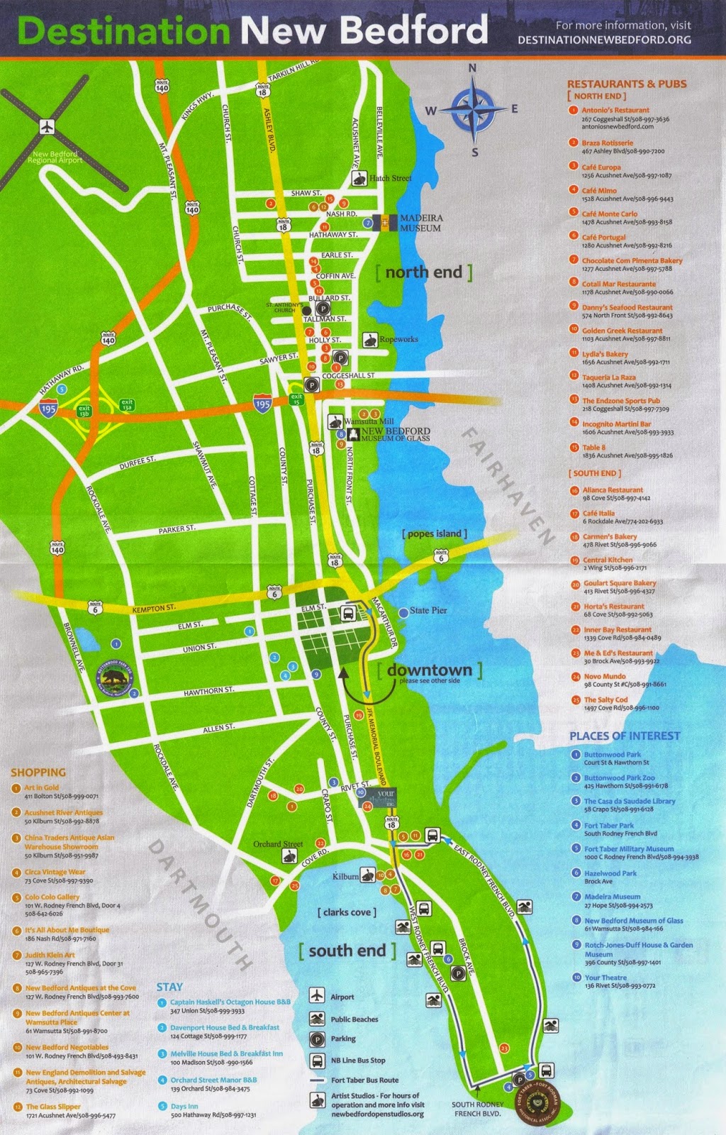
New Bedford Whaling National Historical Park, established in 1996, comprises 34 acres of New Bedford, encompassing a number of dispersed historic sites and the famous New Bedford Whaling Museum. The only parts of the historical park owned by the U.S. National Park Service are the visitor centre and a maritime learning centre; the rest of the park is administered through a partnership between the National Park Service, the City of New Bedford, and private building owners who have agreed to preserve historic structures and landscapes and promote research and educational programs on the history of whaling.
 |
| The Visitors Center of the New Bedford Whaling Historical Park, operated by the U.S. National Park Service. The building was formerly the Third District Court House and, before that, a bank. The Corson Maritime Learning Center is connected to the Visitors Center. |
 |
| A large wall map depicting New Bedford in the 19th century, when it was known as The City that Lit the World due to the enormous quantities of whale oil (used in lamps) landed by whaling ships which plied the world's oceans for their prey. |
 |
The U.S. Custom House at the intersection of William and North Second Streets in historic downtown New Bedford. Constructed in 1836, this two-story granite building designed in the Greek Revival style is the oldest continuously operating custom house in the United States and was also the city's first post office. Captains of whaling vessels registered their ships and cargoes here in the 19th century, and commercial fishing trawlers and cargo ships continue to log duties and tariffs here today with officials of the U.S. Customs Service. The building also continues to serve as a post office.
|
 |
The Andrew Robeson House at the intersection of William and North Second Streets. Originally constructed in 1821 at another location on North Second Street, this Federal style home was moved on rollers to its current location in 1977-78 after it was threatened with demolition. Robeson was a wealthy whaling merchant and his house reflects the vast sums earned in the 19th century from the whaling industry. The original house sat on an estate spanning two city blocks.
|
 |
| Freestones City Grill at the intersection of William and North Second Streets occupies the former Citizen's National Bank building, built in 1877. The rectangular hand-cut stone bricks on the exterior of the building were later added by the Citizen's National Bank. A fire in 1934 destroyed the third floor of the building, and a second fire in 1951 (when the building was a bar and restaurant named Haskell's) left scorch marks on rear pillars in the dining room which can still be seen today. The present restaurant has been in business since 1979. |
 |
| A retail store in a preserved 19th century building at the intersection of Acushnet Avenue and William Street. |
 |
| The Benjamin Rodman House on North Second Street, behind the Visitor Center. By the time this stately home was constructed by whaling merchant Benjamin Rodman in 1821, most of the city's wealthy class were moving uphill, away from the harbour. Rodman and his wife Susan were founding members of the New Bedford Benevolent Society, established to assist the working poor, as well as abolitionists. By the 1890s, this house was surrounded by warehouses and storefronts, and it was used as a warehouse for forty years until purchased by the Waterfront Historic Area League in 1965 and restored to its original look. |
|
|
|
|
|
|
|
|
|
|
|
|
|
 |
| Moby Dick Retail, a nautical themed gift store located in the former Corson Building at the corner of First and William Streets. The store sells a variety of interesting items, including brass lamps, local pottery, ship models, and clothing. |
 |
| A wooden sailboat model purchased at Moby Dick Retail in New Bedford, Massachusetts. Cost: $25.50 (including tax). |
 |
| The Mariners' Home was established by the daughter of wealthy whaling merchant William Rotch Jr. to feed and shelter needy seamen. As most sailors were poor, unskilled, and homeless between voyages, the Mariners' Home served an important role. Retired whalemen and merchant seamen lived here after the decline of the whaling industry, and the Mariners' Home still caters to sailors today. |
 |
| The Seamen's Bethel, a chapel for mariners, opened by the New Bedford Port Society for the Moral Improvement of Seamen in 1832 to 'protect the rights and interests of Seamen, and to furnish them with...moral, intellectual and religious instruction.' The Society hoped that the spiritual guidance offered at the Bethel would dissuade sailors from the attractions of liquor and brothels which were pervasive in the working harbour town. |
 |
A building on Water Street, built in 1831, which formerly housed two banks for 61 years, the Merchants Bank on the right side and the Mechanics Bank on the left side. Most of New Bedford's banks, insurance companies, telegraph offices, law firms, and broker's offices were located along Water Street.
|
 |
| The former Rodman Candleworks at the corner of Water and Rodman Streets. Built around 1810, this is one of only two surviving candleworks buildings in New Bedford, which in 1849 hosted 19 candlehouses and oil refineries. The Rodman Candleworks produced wax candles made from spermaceti, the solid, waxy substance harvested from the heads of sperm whales. Making spermaceti candles took nearly a year and required repeated pressing, congealing, and heating; however, the high-quality candles burned clean, long, and bright. |
 |
The faded grandeur of downtown New Bedford reflects the rise and fall of whaling and the money that the industry once generated for the city.
|
 |
New Bedford City Hall at the intersection of William and Pleasant Streets. Built in 1857, the building housed New Bedford's public library until 1910, when the growth of the municipal government necessitated a swap between the library and the city hall, located across the street. A notable feature inside City Hall is the semi-circular elevator installed in 1906; it is the oldest working elevator in the United States.
|
 |
| The New Bedford Free Public Library, until 1910 the city hall, located on Pleasant Street between William and Market Streets. The library houses an extensive collection of records from whaling journeys, 19th century art, as well as historical and genealogical records. |
 |
The famous Whaleman's Statue, dedicated with the inscription 'A Dead Whale or a Stove Boat. In Honor of the Whalemen Whose Skill, Hardihood and Daring Brought Fame and Fortune to New Bedford and Made its Name in Every Seaport on the Globe'. Located in front of the New Bedford Free Public Library, the memorial to those who served in the whaleships was designed by sculptor Bela Lyon Pratt and unveiled on 20 June 1913. The memorial was paid for by William P. Crapo, a New Bedford-born lawyer and politician and cost $25,000 (equivalent to $475,000 today).
|
 |
The New Bedford Ocean Explorium, a hands-on museum encouraging youth interest in marine science and biology, housed in the former New Bedford Institution for Savings building. On 31 August 2014, the Explorium closed to permit its relocation to New Bedford's Buttonwood Park Zoo.
|
Photographs of other heritage buildings in New Bedford's downtown historic district:
Below: A brochure for the schooner Ernestina, a historic sailing vessel homeported in New Bedford Harbor.
New Bedford Whaling Museum
Established in 1907 and operated by the Old Dartmouth Historical Society, the museum occupies an entire city block and recounts the history of the whaling industry and the 'Old Dartmouth' area, comprising the towns and cities along the southern coast of Massachusetts. The museum's inventory contains over 750,000 items in 20 galleries, including the world's largest collection of scrimshaw (whale ivory carvings) and whaling ship logbooks, as well as works of fine and decorative art, glassware, and furniture acquired by New Bedford's wealthy whaling merchants. Five complete whale skeletons are displayed inside the museum, and the Cook Memorial Theatre plays films on whaling, fishing, and local history. A research library caters to scholars of the whaling industry and, in 2002, the museum partnered with the Melville Society to house the latter's extensive collection related to Moby Dick author Herman Melville.
 |
| The main entrance to the New Bedford Whaling Museum. The Museum is housed in the former Bank of Commerce Building on Water Street, which was donated to the Old Dartmouth Historical Society by industrialist and financier Henry Huttleston Rogers in 1906 for the purpose of housing the museum's collection. |
 |
| The distinctive whale weathervane atop the cupola on the roof of the Jonathan Bourne Building, one of the galleries of the New Bedford Whaling Museum. |
 |
A skeleton of a 37-foot long male humpback whale in the museum's main entrance hall. This whale was found washed up dead on an island off the southern coast of Martha's Vineyard in 1932, and has been hanging in the museum since 1936, and here in the main entrance hall (the Jacobs Family Gallery) since 2000. The carcass was stripped of its flesh and buried in the sand to further clean the bones, followed by placement on the museum's roof to dry and bleach under the sun for three years. Slow-swimming humpback whales follow a regular migration route, spending summers feeding in polar waters and wintering in tropical waters, where they mate and give birth--female humpbacks produce one calf every 2-3 years. Humpback populations have slowly recovered following the ban on commercial whaling enacted in 1966 and further strengthened in 1985.
|
 |
| The Jacobs Family Gallery, in which are displayed the skeletons of a blue whale, a humpback whale, and a right whale with her unborn calf. The gallery also contains various ship models, nautical artefacts, and large wall maps and imagery. |
 |
| A scale model of the Charles W. Morgan, a whaling ship built in New Bedford in 1841. The Morgan made 37 voyages during 80 years of service, harvesting 54,483 barrels of spermaceti and whale oil and 152,934 pounds of whalebone from catches in the Indian Ocean and South Atlantic. Over 1,000 whalemen served aboard the Morgan during her lifetime (approximately 33 men per voyage), including many sailors from Cape Verde, New Zealand, the Seychelles, Guadaloupe, and Norfolk Island. The Morgan is the only surviving American whaling ship and is now homeported at the Mystic Seaport museum in Mystic, Connecticut. |
 |
| In the foreground, a 66-foot juvenile blue whale skeleton named KOBO (King of the Blue Ocean) hangs from the ceiling of the New Bedford Whaling Museum's Jacobs Family Gallery. Although this whale died after colliding with a ship in March 1998 and has been hanging in the gallery since 2000, oil continues to drip out of its skull to this day--scientists estimate the seepage could continue until 2060 or later. |
 |
A wall map plots out the location of each whale killed in the world's oceans over the course of the commercial whaling industry. The plots are known from the vessels' logbooks.
|
 |
| The full skeleton of a 48-foot juvenile sperm whale is the centerpiece in the museum's principal gallery, From Pursuit to Preservation: the Global Story of Whales & Whaling. The gallery focuses on the environmental, economic, and social impacts of whaling on the world. This whale died after beaching on Nantucket Island in June 2002, with installation in this gallery complete by March 2005. |
 |
| A whaling boat of the type carried aboard whaleships and used to chase down whales spotted by the ship's lookouts. The faster, more manoeuverable boats used sails and/or oars to come alongside a whale and harpoon it, after which the whale would be towed back to the ship to be cut apart and rendered down for its oil. |
 |
A displays of harpoons, knives, and other butchering implements used in whaling over the years.
|
 |
| A whaleship's wheel on display. |
 |
| The world's largest model ship, the whaleship Lagoda, resides here in the museum's Jonathan Bourne Building, built in 1915 specifically to house the model. The building was the gift of Emily Bourne, daughter of whaling merchant Jonathan Bourne Jr., and the Lagoda was constructed inside. |
 |
| The half-scale Lagoda is a fully-rigged whaleship measuring 59 feet long and 50 feet high at the mainmast, and is depicted in readiness for an extended whaling voyage. Visitors may climb aboard and explore the ship. |
 |
| The Harpoons and Whalecraft exhibit in Bourne Hall traces the development of the weapons used to hunt whales. The high-risk business of whaling drove innovations in design, creating a wide range of harpoons, lances, bow-chaser cannons, shoulder guns, and explosive devices. |
 |
Various implements of the whaling industry. These pots were used in the tryworks aboard a whaleship to boil down whale blubber for oil.
|
 |
The different grades of whale oil. In the left beaker, oil from the blubber of sperm whales brought good profits. The middle beaker contains the low value 'brown and stinking' oil harvested from a pilot whale. The beaker on the right contains pure spermaceti oil taken from the head of the sperm whale; this was the most highly-prized oil and was used in candle manufacturing due to its clean-burning nature.
|
 |
Looking down at the Lagoda from the second floor gallery of the Bourne Building.
|
 |
| A view of New Bedford's harbour from the observation deck of the New Bedford Whaling Museum. |
 |
| The Art of the Ship Model gallery displays models from the collection of the New Bedford Whaling Museum and others on loan. The gallery encourages visitors to recognise ship modelling as a legitimate form of decorative art and contains examples of yachts, American whaleboats, half-hull models, Arctic small craft, and whaling vessels from the age of sail to today. |
 |
| A glass case contains several models of the American whaleship Charles W. Morgan, constructed by different individuals of varying skill level. |
 |
| A display of American whaleboats from the age of sail. |
 |
| A gallery devoted to the history of Old Dartmouth, the southern coastal region of Massachusetts, comprising the towns of New Bedford, Fairhaven, Dartmouth, Westport, and Achushnet, settled largely by Quakers and Baptists. The figurehead depicts Bartholomew Gosnold, the English lawyer, explorer, and privateer who was instrumental in the founding of the Virginia Company in London and the Jamestown colony in Virginia, and is also credited with making the first landing on Cape Cod (at Provincetown) on 15 May 1602. |
 |
A gallery dedicated to the glassware manufactured by local companies, including Pairpoint and Mt. Washington Glass. The city's first glassworks, the New Bedford Glass Company, was built in 1866 and taken over by Mt. Washington Glass in 1869, which itself was bought by the Pairpoint Manufacturing Company in 1894. The high-quality cut glass, chandeliers, and everyday glassware produced in New Bedford competed with the better-known Steuben company in Corning, New York.
|
 |
| A display of elegant, decorative lamps manufactured by the Pairpoint glass company of New Bedford. The Pairpoint reverse-painted and 'puffy' table lamps were world-renowned. Pairpoint went out of business in 1957, undercut by cheap imported glassware from postwar Europe. |
 |
Several examples of scrimshaw, hand-engraved folk art made by sailors using the bones and teeth of whales and walruses. The New Bedford Whaling Museum holds the world's largest collection of scrimshaw, much of which depicts nautical scenes, as would be expected by the sailor-artists.
|
 |
| Examples of intricately-carved scrimshaw Japanese whale ivory figures. The exhibit features scrimshaw by English, Scottish, Azorean, Cape Verdean, African-American, Continental European, Inuit, Pacific Island, and Japanese craftsmen. Many of the items from the museum's extensive collection are on display for the first time ever. |
 |
| A watch stand fashioned out of wood and whale ivory. The scrimshaw exhibit features a variety of art and functional objects from around the world, including pictorial sperm whale teeth, walrus tusks, canes, corset busks, watch hutches, birdcages, and tools and other implements for the kitchen and home. |
 |
| Fairhaven artist William Bradford's painting of ships in the Arctic, part of an exhibit dedicated to Bradford's 1869 Arctic voyage, entitled Arctic Visions: Away then Floats the Ice-Island at the New Bedford Whaling Museum. Bradford's three month sea voyage from St. John's, Newfoundland up the western coast of Greenland aboard the sealing ship Panther was carried out specifically for the purpose of art. During the voyage, Bradford produced dozens of sketches, drawings, paintings and photographs. A collection of photographs from the expedition was published in a 20" x 25" folio in 1873, principally sponsored by Queen Victoria. Only 300 copies of Bradford's folio, The Arctic Regions: Illustrated with Photographs Taken on an Art Expedition, were printed, three copies of which currently reside in the New Bedford-Fairhaven area. In later life, Bradford became a lecturer on the Arctic. He died in 1892. |
 |
| A look inside Arctic Visions: Away then Floats the Ice-Island. The gallery seeks to explore 'the intersections between art, exploration, and human impact on and understanding of the environment'. An original copy of William Bradford's The Arctic Regions: Illustrated with Photographs Taken on an Art Expedition is on display in a glass case. |
Elsewhere in New Bedford...
 |
| A pedestrian pier juts into New Bedford Harbor at the 47-acre Fort Taber Park at the city's southern extremity. The Acushnet River empties into New Bedford Harbor, which opens onto Buzzards Bay. |
 |
| Fort Taber, the uncompleted Civil War fort built in New Bedford. Although construction commenced in the late 1850s, work was halted in 1871, and the fort was never completed. It is currently awaiting restoration and is not open to the public. |
 |
| A view of Fort Taber Park from an abandoned and overgrown Second World War-era gun emplacement. Buzzards Bay can be seen beyond the grassy expanse. |
 |
| Historical re-enactors in Revolutonary War period costume relax beside their tents in preparation for a mock battle with counterparts playing British troops. |
 |
| Reproduction cannons ready for tomorrow's recreation battle between American patriots and British troops. |
 |
| Other re-enactors playing troops of the British 10th Regiment of Foot prepare an authentic dinner of roasted meat in the field kitchen using period utensils and cooking implements. |
 |
| An ornate fountain near the Waterfront Visitors Center portrays the riches of the sea, including a swordfish, a dolphin, octopi, turtles, cod, and various shellfish. |
Some views of the commercial fishing trawlers that call New Bedford Harbor home. The scallops, cod, and other seafood landed here by these vessels makes New Bedford the largest commercial fishing port in the United States by value of catch:
Day 9 (24 August): Fall River, MA
 |
| The main entrance to Battleship Cove naval museum in Fall River, Massachusetts. |
 |
One of the 38,030 pound bronze-manganese propellers taken off the battleship USS Massachusetts during a 1998-99 drydocking. One of four identical propellers manufactured at the Philadelphia Navy Yard, they drove the 36,000 ton USS Massachusetts at speeds up to 29 knots (53.7 km/h, 33 mph).
|
 |
A view of the vessels of Battleship Cover naval museum. Left to right: USS Joseph P. Kennedy Jr.; USS Lionfish; German Navy corvette Hiddensee; and USS Massachusetts.
|
 |
| The gangway leading aboard USS Massachusetts (BB-59). |
 |
A starboard view of the USS Massachusetts, a South Dakota-class battleship built at Bethlehem Steel's Fore River Shipyard in Quincy, Massachusetts and commissioned on 12 May 1942. USS Massachusetts served initially in the Atlantic but was transferred to the Pacific in 1943, after which she participated in campaigns against the Japanese in the Solomon Islands and fought in the Battle of Leyte Gulf in the Philippines. After shelling the largest Japanese home island of Honshu near the end of the war, Massachusetts returned to the United States and took part in routine operations until decommissioned on 27 March 1947. The ship resided in the reserve fleet until 1962 when it was stricken from the Naval Vessel Registry and, following an intense fundraising campaign by the people of Massachusetts, was transferred to Battleship Cove in 1965, becoming the first ship in the museum's collection.
|
 |
| The German Navy corvette Hiddensee in the foreground and the Gearing-class destroyer USS Joseph P. Kennedy Jr. in the background. |
 |
The waterfront of Fall River, with the tower of the Fall River Trial Court in the distance, as seen from the starboard side of USS Massachusetts.
|
 |
The Charles M. Braga Jr. Memorial Bridge spanning the Taunton River, as seen from the port side of USS Massachusetts. The cooling towers of the coal- and fossil fuel-fired Brayton Point Power Station can be seen in the distance.
|
 |
| One of the 10 twin-mount 5-inch gun turrets aboard USS Massachusetts. |
 |
| The USS Massachusetts' bell. |
 |
| Looking aft from the bow of USS Massachusetts. The forward 16-inch gun turrets are prominent features. |
 |
Each of the USS Massachusetts' three 16-inch gun turrets house three guns capable of throwing a 2,700 pound armour-piercing shell 36,900 yards (21 miles; 33.7 km). Rate of fire for each gun was two rounds per minute.
|
 |
| The turret booth inside of one of the 16-inch gun turrets aboard USS Massachusetts. Located behind the gun rooms and powder hoists, this was where operations in the turret were controlled by the turret officer, rangefinder and rangekeeper operators, and telephone talkers. Periscopes inside the turret permitted the turret officer to see outside. |
 |
A shell fragment from a 2,700 pound armour-piercing shell fired by USS Massachusetts at the French battleship Jean Bart during the Battle of Casablanca, 8 November 1942. The shell, fired from a distance of 12 miles, penetrated 10.5 inches of Jean Bart's armour and decking to detonate in an empty powder magazine. The Battle of Casablanca was USS Massachusetts' first combat engagement.
|
 |
The longest fore and aft passageway running down the centre of USS Massachusetts, on Third Deck. This passageway was nicknamed Broadway because it was always brightly lit and busy. From Broadway, the crew could access all four engine rooms and the 5-inch magazines and 5-inch lower handling rooms. A battle dressing station was also located off Broadway. When the ship went to action stations, the watertight hatches along Broadway would be sealed.
|
 |
| The galley aboard USS Massachusetts. |
 |
| The Warrant Officers Mess on Second Deck. |
 |
| Shell hoists for 5-inch ammunition. |
 |
| Engine Room B1 aboard USS Massachusetts. |
 |
| Part of the Radio Central/Combat Information Center. |
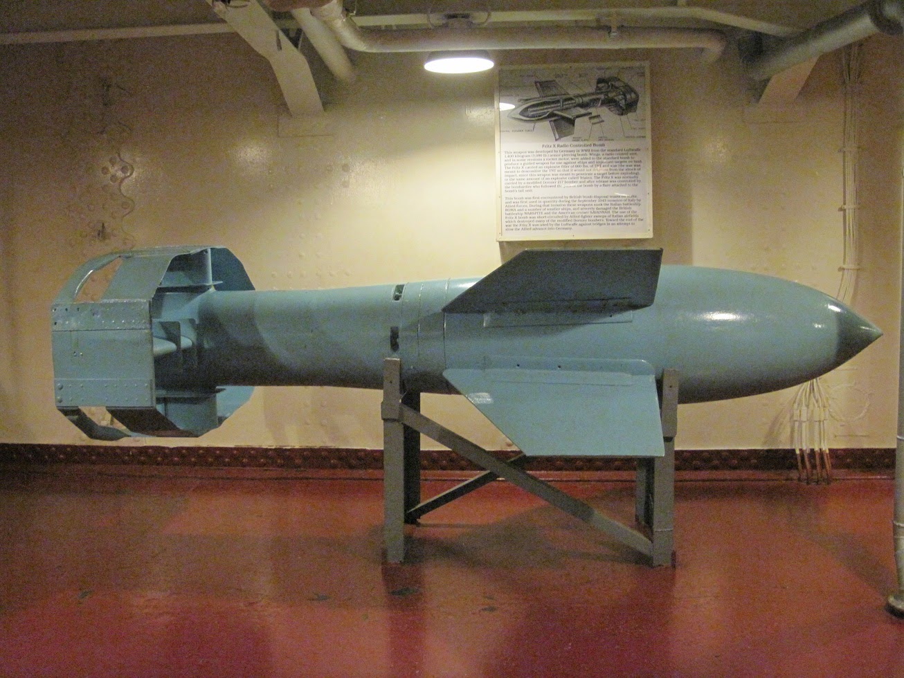 |
| A Second World War-era German Fritz X bomb. These 3,000 pound anti-ship guided bombs contained a 705 pound armour-piercing warhead and had a range of 3.1 miles (5 km). The bombs were dropped from bomber aircraft and remotely guided onto their targets by a bombardier using a joystick and radio link. The Germans attacked the Italian battleship Roma with Fritz X bombs on 9 September 1943, sinking her before she could surrender to the Allies following Italy's capitulation. |
 |
A model of the U.S. Navy Baltimore-class heavy cruiser USS Saint Paul, part of an exhibit about the ship in an aft compartment aboard USS Massachusetts. Built in Quincy, Massachusetts and commissioned on 17 February 1945, the Saint Paul earned one battle star for service in the Second World War, eight battle stars for service in the Korean War, and another nine battle stars for her Vietnam War service. The ship was decommissioned in 1971 and scrapped in 1980.
|
 |
The flag plot, located aft of the conning station/pilot house high atop USS Massachusetts.
|
 |
| Looking up at USS Massachusetts' conning tower and signal decks. |
 |
A view of Battleship Cove's other museum ships, as seen from the USS Massachusetts' starboard signal deck.
|
 |
| The former German Navy Tarantul I-class missile corvette Hiddensee. Launched in 1984 at the Petrovsky Shipyard in Leningrad, Russia and commissioned by the East German Volksmarine in 1985 as the Rudolf Engelhofer, the ship was transferred to the German Navy following reunification in 1990 and renamed Hiddensee. |
 |
| The bridge of the Hiddensee. |
 |
| The Hiddensee's galley. |
 |
| A closeup view of the Hiddensee's P-15 Termit (NATO codename SS-N-2 Styx) anti-ship missile boxes. The ship carried four missiles, two on each side. The P-15 has a range of 40km and flies between 100 and 300 metres above sea level at a speed of Mach 0.9. |
 |
Following its decommissioning in 1991, Hiddensee was transferred by the German Navy to the U.S. Navy where it was renamed USNS Hiddensee and extensively tested at the Naval Air Warfare Center and used in exercises. Budget cuts forced Hiddensee's retirement in 1996 and she was transferred to Battleship Cove on 14 June 1997. She is the only Tarantul I-class corvette on display in North America.
|
 |
| Looking forward along the upper casing of the Balao-class submarine USS Lionfish. Lionfish is 311 feet, 6 inches long, displaces 2,463 tons submerged, and was capable of 20.25 knots (37.5 km/h) surfaced and 8.75 knots (16.21 km/h) submerged. Endurance was 48 hours at 2 knots submerged, with a typical patrol lasting 75 days. The Lionfish carried 10 officers and 70 enlisted men. Armament consisted of 24 21-inch torpedoes, fired from six tubes forward and four tubes aft, as well as a 5-inch deck gun and smaller anti-aircraft weapons. |
 |
| The USS Lionfish was launched on 7 November 1943 and commissioned on 1 November 1944. Following two war patrols in Japanese waters in 1945, Lionfish was decommissioned in January 1946. Recommissioned in January 1951, Lionfish took part in training cruises and NATO exercises before decommissioning again in December 1953. Following a third commission as a reserve training boat at Providence, Rhode Island from 1960 to 1971, Lionfish was retired and transferred to Battleship Cove and went on display in 1973. |
 |
| A cramped officers' cabin aboard USS Lionfish. |
 |
| The control room aboard USS Lionfish. |
 |
| The mess aboard USS Lionfish. |
 |
One of two engine rooms aboard USS Lionfish, containing two of the four Fairbanks-Morse 9-cylinder diesel engines.
|
 |
| The Gearing-class destroyer USS Joseph P. Kennedy Jr. (DD-580), named after the older brother of future President John F. Kennedy, who was killed while serving as a naval aviator during the Second World War. DD-580 was laid down on 2 April 1945, launched on 26 July 1945, and commissioned on 26 December 1945. After a career involving service in the Korean War, participation in the 1962 naval blockade of Cuba, and support to NASA's Gemini 6 and Gemini 7 space missions, the ship was decommissioned on 2 July 1973 and relocated to Fall River, Massachusetts, where it has been on display at Battleship Cove ever since. |
 |
| A view of the upper deck, looking aft. |
 |
| The RUR-5 ASROC (Anti-Submarine ROCket) launcher located on the upper deck, aft of the forward funnel. This all-weather, subsonic standoff anti-submarine ballistic missile system was developed by the U.S. Navy in the 1950s and installed on many U.S. and allied warships beginning in the 1960s. The rocket could carry either a Mark 46 torpedo with 96.8 pounds of high explosive or a 10 kiloton W44 nuclear warhead out to a range of 12 miles. |
 |
One of the crew messdecks aboard USS Joseph P. Kennedy Jr.
|
 |
| Ship's office. |
 |
| The wardroom aboard USS Joseph P. Kennedy Jr. |
 |
| The engine room control panel aboard USS Joseph P. Kennedy Jr. |
 |
| The USS Joseph P. Kennedy Jr.'s Combat Information Centre, with the Mark 1A fire control computer at the centre. |
 |
| A view of USS Joseph P. Kennedy's bridge. |
 |
| The steering position and engine room telegraphs on the bridge of USS Joseph P. Kennedy Jr. |
 |
| The destroyer's 'brain', the Combat Information Centre, located aft of the bridge. |
 |
| Room 131 at the Hampton Inn & Suites in Springfield, Massachusetts. |